TrackMaker31 – Navigation & Data Logging System for Geonics EM31 Conductivity Meter
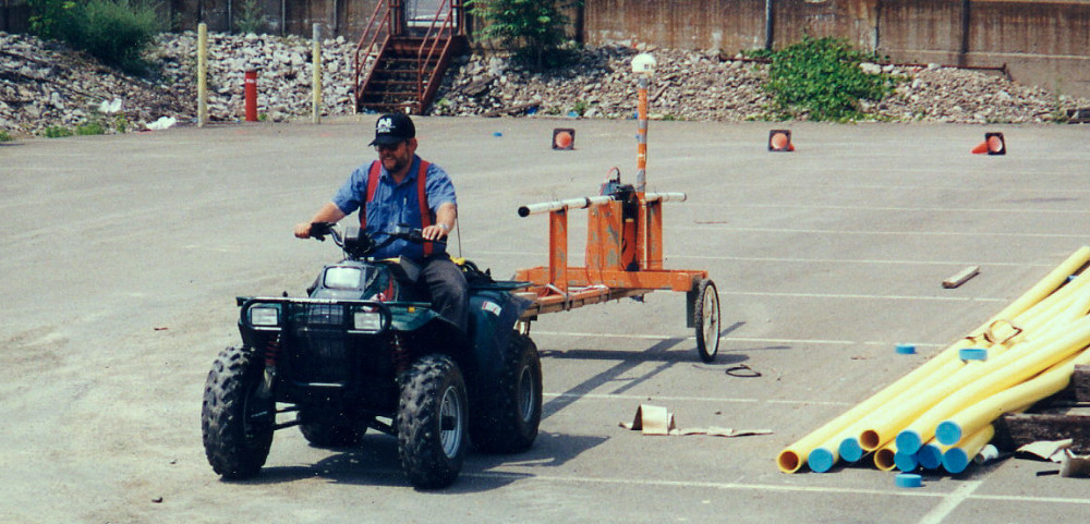
EM31-MK2 Survey
The TrackMaker system for the Geonics EM31 consists of two separate but fully integrated programs:
Nav31 – field data acquisition and navigation software for Windows 11/10–based tablets and field laptops
TrackMaker31 – Windows-based data-processing and XYZ-file generation program
The Geonics EM31 is an electromagnetic conductivity meter widely used in environmental and engineering investigations and near-surface mapping. It measures:
Apparent conductivity (mS/m)
Inphase component (ppt)
Both EM31-MK2 configurations—standard EM31-MK2 (3.66 m boom) and EM31-SH (2 m boom)—are supported by the software.
NAV31 – Field Data Acquisition & Navigation for EM31
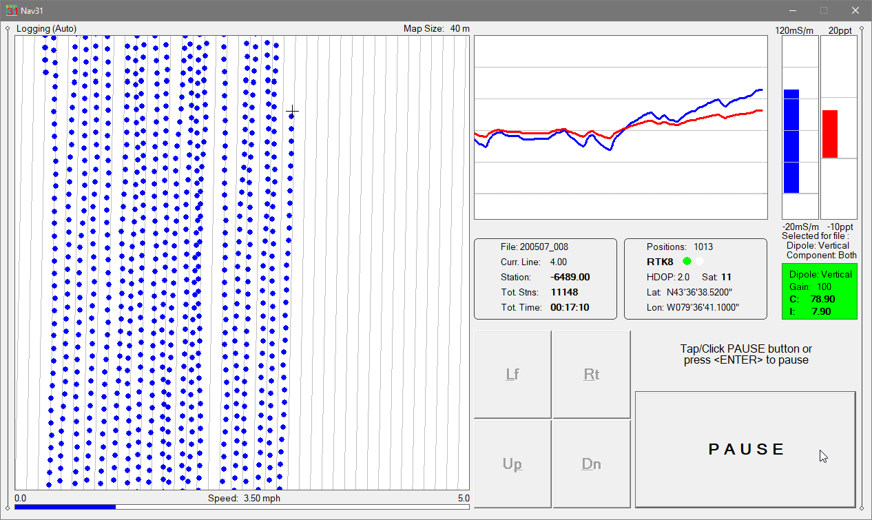
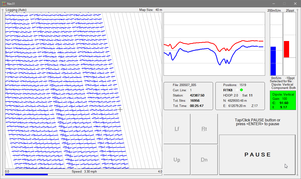
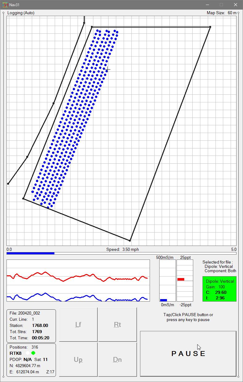
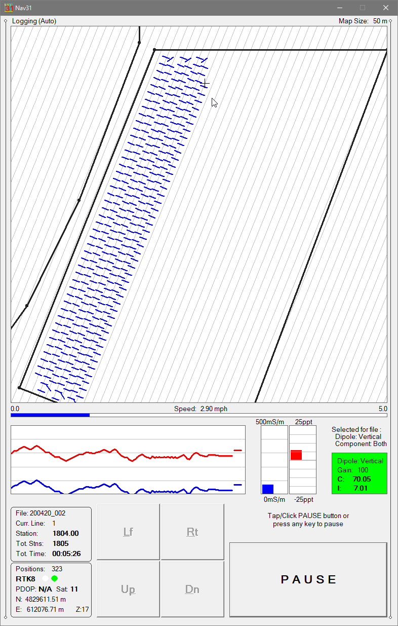
Nav31 - Logging Mode
The NAV31 program provides precise navigation, real-time QA/QC, and synchronized electromagnetic and GPS data logging for EM31 surveys.
Survey coverage is displayed using:
Dots representing individual measurement stations, or
Swath bars representing the user-defined magnetic sensor footprint
This navigation-focused display gives operators continuous control over coverage density, survey-line spacing, and survey progression, helping prevent skipped areas and unnecessary overlap.
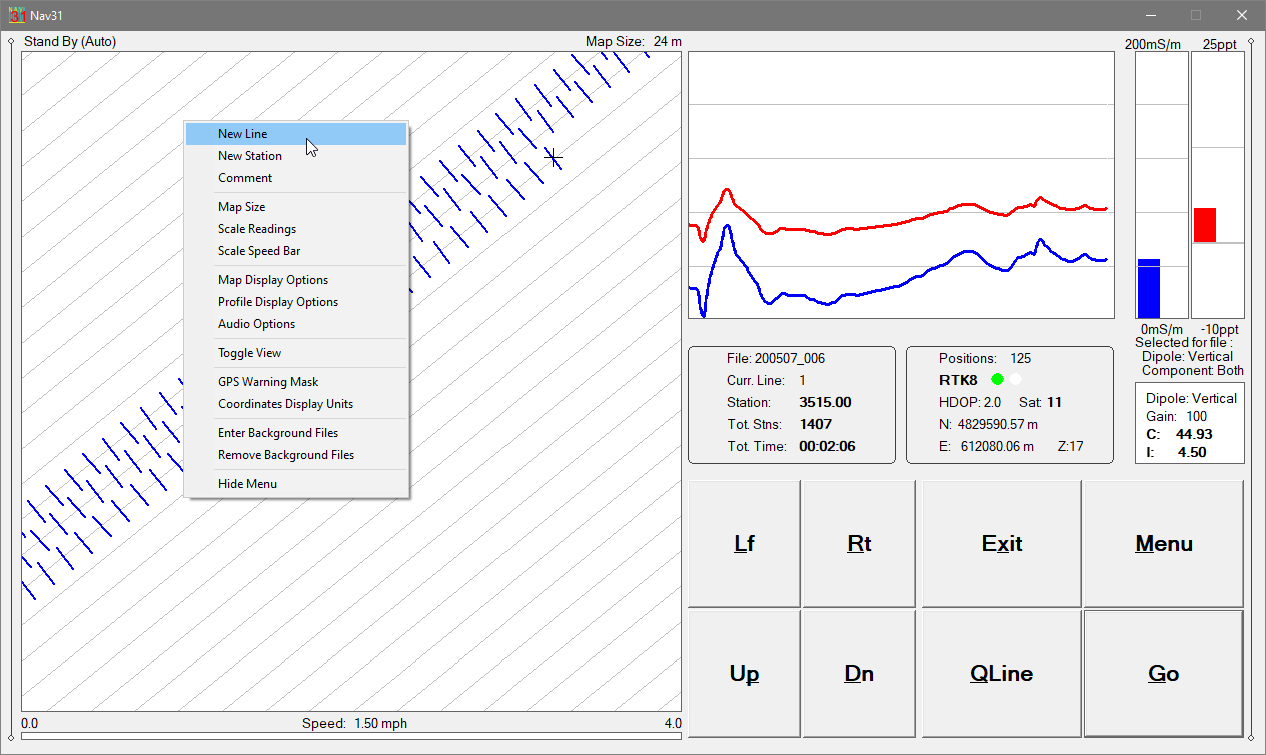
Navigation & Coverage Control
NAV31 guides operators along uniformly spaced survey lines, enabling faster and more consistent site coverage.
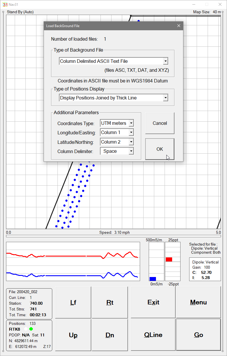
Up to 10 external files (from TrackMaker31 or any other TrackMaker or RTmap supported instruments) can be loaded to assist navigation and spatial context, making it easy to follow boundries, to return to previous stations, or reoccupy survey grids.
Profile View for QA/QC
In addition to the map view, NAV31 provides a Profile View of the collected EM31 data to support field QA/QC. EM31 Conductivity (mS/m) and Inphase (ppt) are displayed as moving graphic bars and numeric values, with continuous monitoring of instrument status and settings.
GPS, RTK & Robotic Total Station Integration
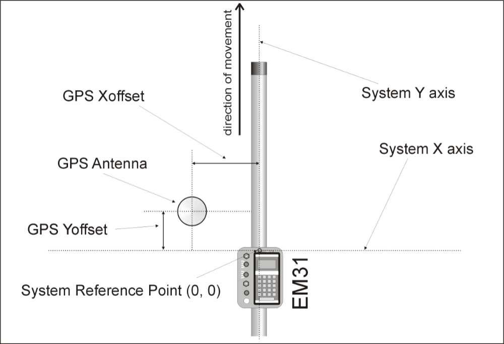
Nav31 - System Geometry Description
NAV31 works with virtually any GNSS/GPS receiver supporting NMEA messages (GGA, POS, GLL, LLQ, LLK, GGK), and with selected robotic total stations.
The software records EM31 and positioning data simultaneously into a single synchronized field file, while monitoring key GNSS/GPS parameters including:
Latitude / Longitude or UTM coordinates
differential correction mode (DGPS, RTK)
PDOP (or equivalent)
satellite count
user-defined GPS Warning Mask status
NAV31 can also convert the field tablet or laptop into a stand-alone GPS/DGPS/RTS logger when the EM31 is disconnected, allowing mapping of site features, grid corners, or interpreted anomalies. This function eliminates the need for dedicated GPS logging equipment.
Field Reliability
NAV31 supports practical field operation in difficult conditions. If survey lines are interrupted by obstacles or pauses, operators can resume at the correct location without tapes, stakes, or visual markers. Surveys can be completed reliably under low visibility or in darkness while maintaining full control over coverage and EM31 data quality.
TrackMaker31 – Data Processing Software
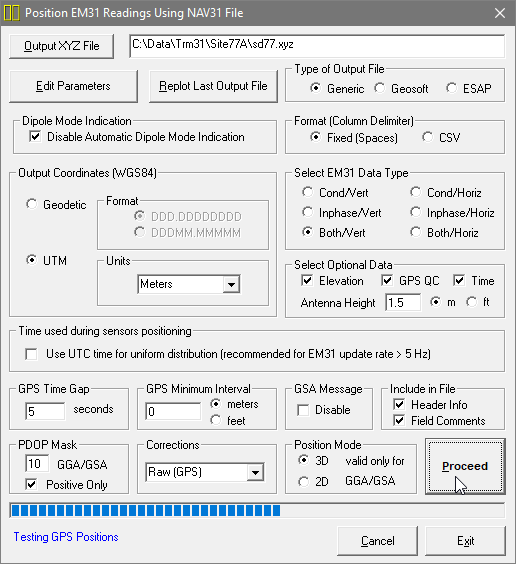
TrackMaker31 - Data Processing, Creating XYZ File
The TrackMaker31 program processes data collected by NAV31 and accurately positions EM31 readings using:
recorded GPS coordinates
antenna offset geometry (any direction)
instantaneous heading and survey configuration
PDOP and differential correction filters
GPS Time Gap and GPS Minimum Interval refinement
The TrackMaker31 can also position EM31 readings using the Nav31 data file and an External GPS File. The latter method is used when real-time differential corrections are unavailable or when post-processed GPS positions are more accurate. GPS positions must be recorded simultaneously in NAV31 and in the external GPS logger.
This workflow produces high-accuracy, georeferenced datasets suitable for general mapping, classification, buried-object detection workflows, and reporting.
TrackMaker31 Demo Version (Data Acquisition Program)
Please try the Nav31 demo program. The demo version operates like the standard program, except that the recorded data file is intentionally short. Monitoring mode operates indefinitely—sufficient to verify instrument communication, GPS/RTK/RTS integration, display modes, and overall performance with your system configuration.