RTmap Programs Available for Windows 11/10 Tablets
RTmap is a professional geophysical survey software system designed for real-time data acquisition, quality control (QA/QC), and efficient field mapping. The RTmap system consists of two separate but fully integrated programs:
Each RTmap software package is individually prepared and optimized for a specific supported geophysical instrument. To learn more about availability and instrument-specific versions, select an item from the right-hand panel (or below on narrow screens).
The RTmap field data acquisition program is available for Windows 11 and Windows 10 field tablets and laptops (recommended), as well as for Microsoft Windows Mobile and Windows CE handheld field computers.
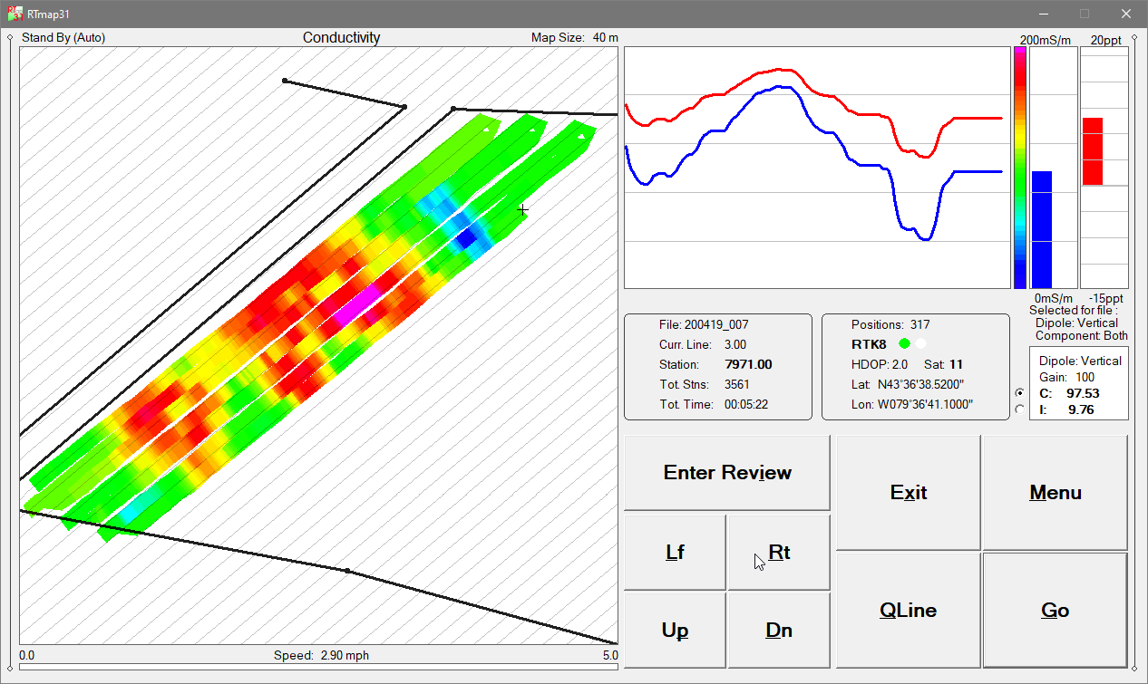
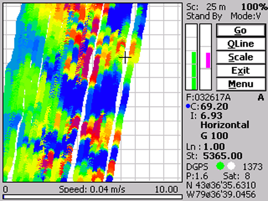
RTmap provides unmatched real-time QA/QC and productivity during geophysical surveys. The real-time spatial color map display allows operators to immediately see survey coverage and anomalies and to adjust survey speed and line spacing accordingly. Using RTmap, field crews can complete surveys faster while maintaining uniform coverage and avoiding missed areas or unnecessary line overlap.
At the same time, RTmap offers full real-time control and monitoring of:
The RTmap data acquisition software works with virtually any GNSS/GPS receiver capable of streaming standard NMEA messages, as well as with selected robotic total stations (RTS), providing maximum flexibility in field survey configurations. Each RTmap version automatically adapts to portrait or landscape screen orientation. For reliable data recording, the screen orientation must be locked, as the software cannot track screen rotation during active data acquisition. In addition to geophysical data collection, RTmap can turn any compatible field computer into a stand-alone GPS/DGPS/RTK data logger, eliminating the need for separate GPS logging hardware.
The RTM data-processing program is available for Microsoft Windows 7, 10, and 11 and is used to process data files recorded by RTmap field software. RTM automatically recognizes and reads data formats created by all previous RTmap versions, ensuring full compatibility with legacy geophysical datasets.
The primary function of RTM is to accurately position geophysical measurement stations and generate XYZ-type output files for: geophysical mapping, modeling and inversion, and interpretation and visualization.
Station positions are calculated using: recorded GPS coordinates, instantaneous system heading, survey configuration, time stamps, user-defined positioning filters.
Survey system configuration includes the offset between the GPS antenna and the center of the geophysical sensor. Using this information, RTM calculates the true instrument position based on antenna offset and direction of travel, producing accurate spatial data ready for import into third-party mapping and interpretation software.
RTmap software (MS Windows 10/11) is available for the following instruments
Available RTmap for MS Windows Mobile & CE Versions:
Please refer to the Legacy Programs Section