RTmap38MK2 – Real-Time Geophysical Survey System for Geonics EM38-MK2 Conductivity Meter
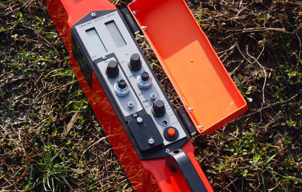
EM38-MK2 Console
The RTmap system for Geonics EM38-MK2 consists of two separate but fully integrated programs:
RTmap38MK2 – field data acquisition software for Windows 11/10–based tablets and field laptops (For Windows Mobile/CE versions, please see Legacy Programs.)
RTM38MK2 – Windows-based data-processing software
The EM38-MK2 provides two intercoil spacings (1.0 m and 0.5 m), allowing operators to record two depths of investigation simultaneously. This makes the EM38-MK2 especially well-suited for agriculture, soil salinity mapping, precision farming, archaeological prospection, and shallow near-surface investigations. The program also supports the EM38-MK2-1 model, which uses a 1 m intercoil spacing, and it automatically recognizes data files generated by this instrument.
RTmap38MK2 Data Logging Software for Geonics EM38-MK2
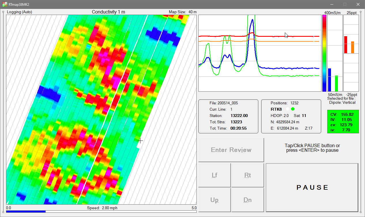
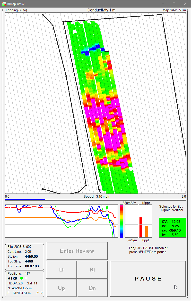
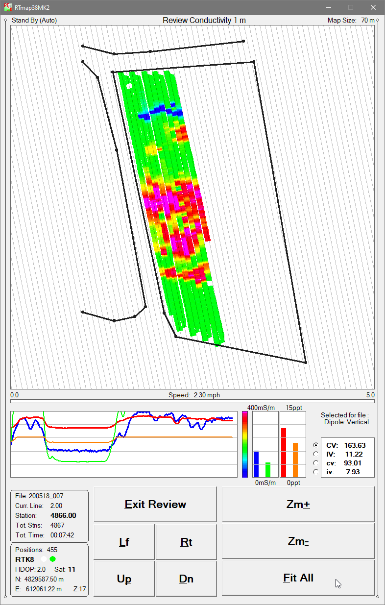
The RTmap38MK2 system provides high-quality real-time QA/QC, optimized for agricultural and archaeological EM38-MK2 surveys. A live spatial color image of EM38-MK2 data enables operators to adjust survey speed, coverage density, and line spacing instantly as anomalies or soil variability appear on the screen.
RTmap38MK2 Logging Mode
RTmap38MK2 maintains precise guidance along uniformly spaced survey lines, helping prevent missed areas and eliminating unnecessary overlap—critical for farmland mapping, soil conductivity management, and archaeological grid coverage.
At the same time, the program provides full real-time control of EM38-MK2 data quality, instrument settings, and GNSS/GPS receiver parameters, including a user-defined GPS Warning Mask.
Both operating modes of the EM38-MK2—1 m intercoil spacing and 0.5 m intercoil spacing—are fully supported, and the software displays both channels (Conductivity and Inphase) for each spacing in real time.
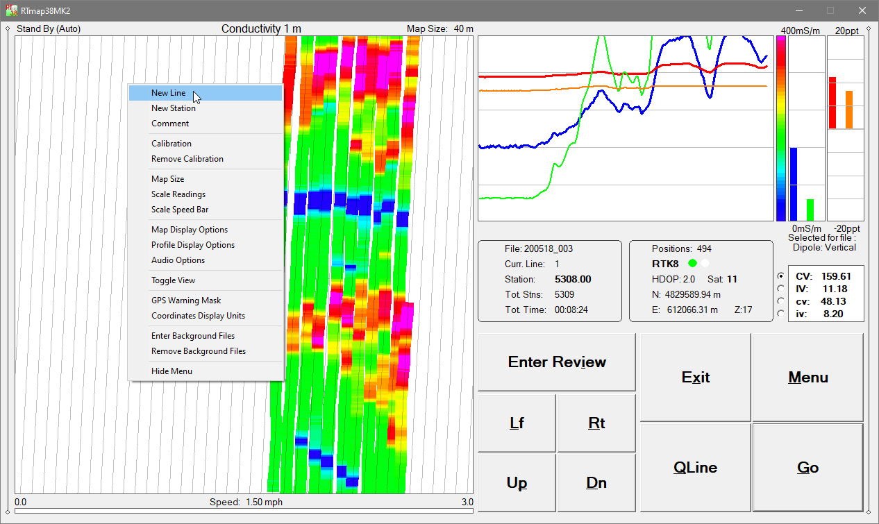
A file-append function allows the operator to load previously collected datasets and visually relocate earlier survey stations or grid cells—ideal for multi-day agricultural mapping or returning to partial archaeological survey areas.
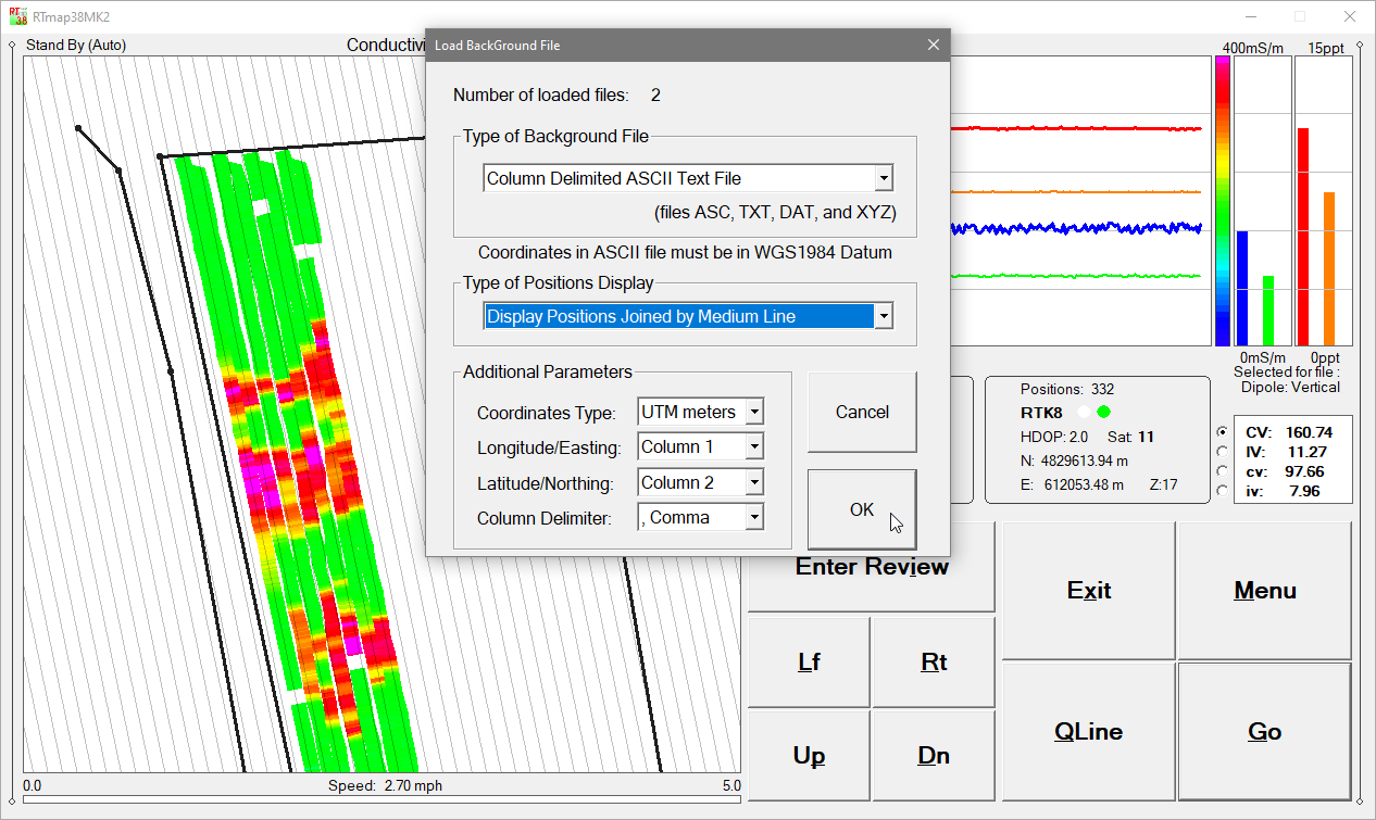
The software supports loading up to 10 external background files, including site boundaries, excavation plans, infrastructure layers, or survey layouts from previous projects—enhancing navigation accuracy and contextual interpretation during data acquisition.
RTmap38MK2 works with virtually any GNSS/GPS receiver supporting NMEA messages (GGA, POS, GLL, LLQ, LLK, GGK), as well as selected robotic total stations. The program records EM38-MK2 and GPS data simultaneously into a single file while displaying a real-time color pseudo-grid of conductivity values.
Survey lines may be resumed at the correct location after obstacles or interruptions without tapes, stakes, or visual markers. The program remains fully functional under low visibility or nighttime conditions—particularly beneficial for agricultural mapping and time-sensitive fieldwork.
RTmap38MK2 can also convert any supported field tablet or laptop into a stand-alone GPS/DGPS/RTK logger, reducing the need for additional GPS hardware.
RTM38MK2 Data Processing Software
The RTM38MK2 program processes data collected by RTmap38MK2 and accurately positions EM38-MK2 measurements using user-defined sensor geometry, GPS coordinates, instantaneous heading, and multiple user-specified filters.
RTM38MK2 produces high-accuracy, georeferenced datasets suitable for: agricultural soil conductivity mapping, salinity and variability analysis, archaeological feature detection, environmental and near-surface investigations, and general mapping.
RTmap38MK2 Features (Field Data Acquisition Program)
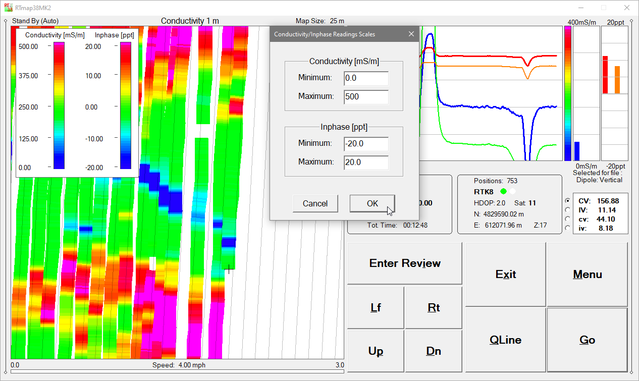
Real-time color imaging for EM38-MK2 user selected Conductivity or Inphase components at both 1.0 m and 0.5 m coil spacings
Real-time calculation and display of EM38-MK2 sensor offset relative to the GPS antenna
User-defined map scale (meters or feet), grid/guide-line spacing, map tilt, and adjustable cursor band with automatic scrolling
Conductivity and Inphase displayed as moving graphic bars and numeric values for both coil spacings
GPS antenna position in Latitude/Longitude or UTM (m/ft), differential correction mode (DGPS, RTK), PDOP/HDOP, satellite count, and GPS/RTS fix count
Continuous GPS signal monitoring and user-defined GPS Warning Mask
Support for up to 10 external background files (site boundaries, excavation plans, previous survey layouts)
Map panning controls in all directions
Continuous visual and audible monitoring of EM38-MK2 console and GNSS/GPS connections
Audio functions: Tik-Tak indicator for active data recording, Alarm Ring for EM38-MK2 or GPS disconnection, and Soft Alarm for GPS Warning Mask events
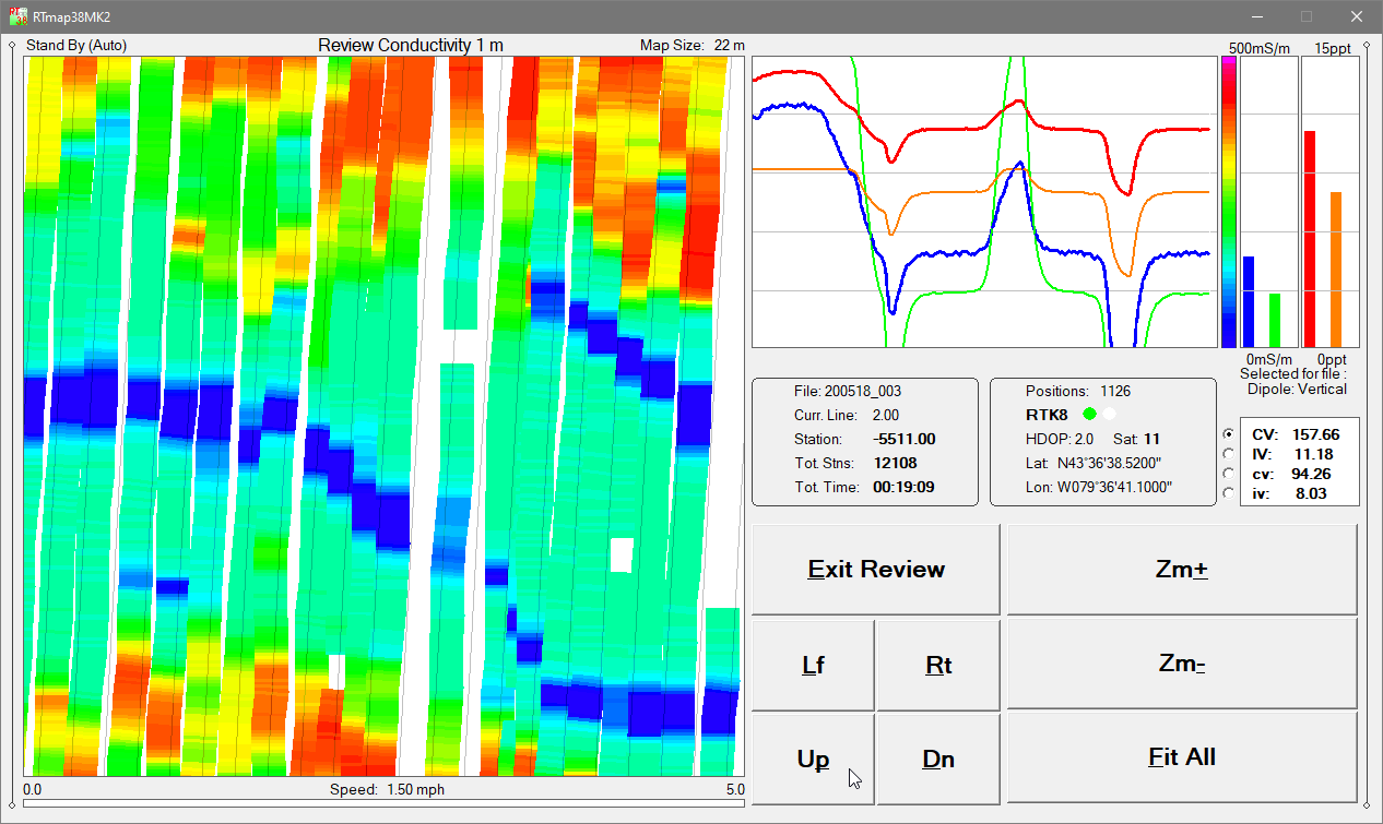
Review mode: pseudo-grid visualization with Zoom In/Out, Pan, zoom step selection, and component selection
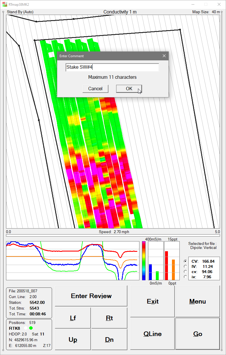
Tablet-optimized interface with enlarged fonts, improved layout, and soft-keyboard-friendly dialogs designed for the field use
RTmap38MK2 Demo Version
A RTmap38MK2 demo program is available. The demo behaves like the full version except that its sample data file is intentionally short. Monitoring mode operates indefinitely, allowing operators to test instrument connections, GPS integration, and software performance.