Multi-Sensor Data Logging System for Geonics EM61-MK2 Array
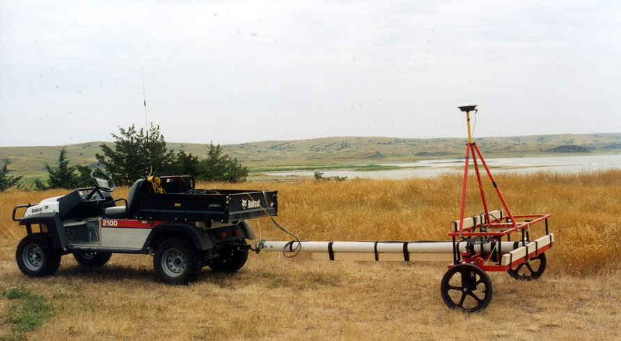
EM61-MK2 Array (photo courtesy of USA Environmental Inc.)
The ML61MK2xpn system is a high-productivity multi-sensor geophysical data-logging solution designed specifically for arrays of Geonics EM61-MK2 metal detector sensors operating simultaneously in single-row or dual-row configurations. The system is optimized for UXO detection and clearance surveys, delivering wide-swath coverage and significantly increased field efficiency.
All types and models of Geonics EM61-MK2 instruments are fully supported. The ML61MK2xpn software runs on rugged Windows-based tablets or laptops, providing real-time data acquisition, navigation, and quality assurance/quality control (QA/QC) capabilities during field surveys.
The ML61MK2xpn system consists of two fully integrated programs: the ML61MK2xpn field data acquisition software and the Multi61MK2 data-processing program.
Wide-Swath UXO Surveys with Multi-Sensor Arrays
ML61MK2xpn dramatically increases survey productivity in environments where multiple EM61-MK2 instruments can be deployed as a single sensor array. The software supports simultaneous data acquisition from up to nine EM61-MK2 consoles, together with one GNSS/GPS receiver, recording all measurements into a single synchronized data file.
By providing real-time navigation, survey line guidance, and quality control, ML61MK2xpn ensures uniformly spaced survey lines, prevents skipped areas, and eliminates unnecessary overlap. This results in faster survey completion times and consistent, defensible UXO datasets.
Description of Array Geometry (5 units example)
Real-Time Mapping, Navigation, and QA/QC
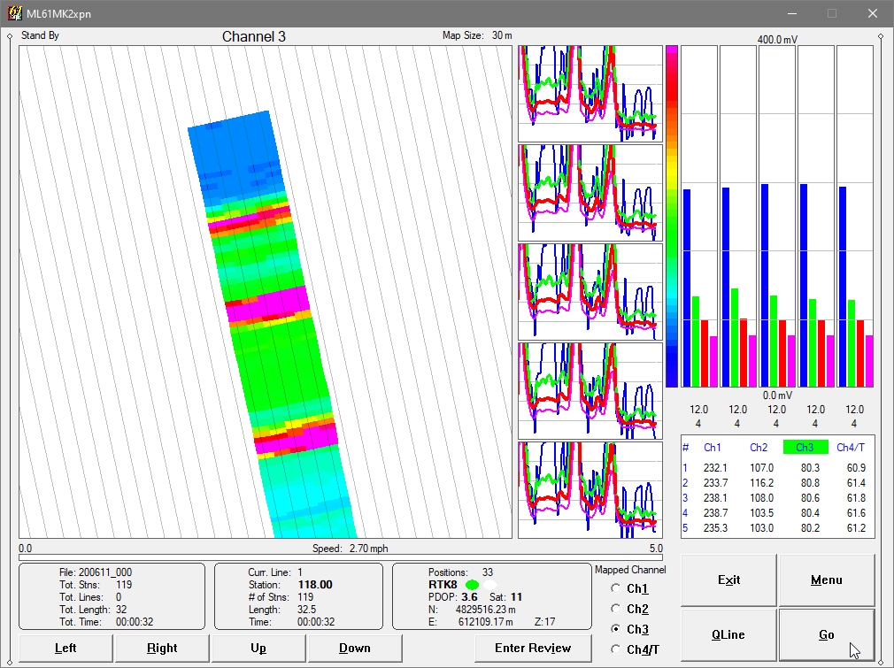
The ML61MK2xpn field program features real-time spatial mapping of all connected EM61-MK2 sensors. Logged positions are displayed as either a color-coded grid image or a scaled array swath, allowing operators to immediately identify anomalies and adjust survey speed and coverage density directly in the field.
The software supports loading up to 10 external background files, including site boundaries, infrastructure layers, and survey layouts from previous datasets. This capability improves navigation accuracy and helps maintain precise coverage over complex UXO sites.
GNSS/GPS and Robotic Total Station Integration
ML61MK2xpn works with virtually any GNSS/GPS receiver by supporting multiple NMEA message formats, and also integrates with Trimble and Leica robotic total stations (RTS). The software provides simultaneous graphical and numeric displays of EM61-MK2 data, GPS parameters, positioning quality indicators, and coordinates, delivering comprehensive real-time QA/QC during data acquisition.
Multi61MK2 Data Processing Software
The accompanying Multi61MK2 Windows-based data-processing program is designed to process data collected by the ML61MK2xpn field software. Multi61MK2 accurately positions each EM61-MK2 sensor using user-defined array geometry, recorded GPS positions, instantaneous array heading, and user-specified filters.
This processing workflow produces high-accuracy, georeferenced datasets suitable for UXO detection, mapping, classification, and clearance reporting, supporting both land-based and marine UXO operations.
Key Features of ML61MK2xpn (Field Data Acquisition Software)
Real-time color mapping with user-defined color scales for selected EM61-MK2 channel amplitudes
Live position indicator with wide-swath array visualization
Adjustable map scale, grid or guide-line spacing, map tilt, and cursor band
Four-channel EM61-MK2 equalizer bars, scrolling profiles, and numeric displays for all connected sensors
Support for up to 10 external background files (site limits, infrastructure, previous survey lines)
Append-to-file option for extending existing UXO datasets
Continuous visual and audible monitoring of EM61-MK2 consoles and GNSS/GPS connections
Individual battery-level monitoring for each EM61-MK2 unit
Monitoring of GPS satellite count, PDOP, position quality indicators, and user-defined GPS Warning Masks
Map panning controls in all directions
Position display in Latitude/Longitude or UTM coordinates
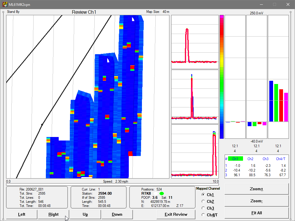
ML61MK2xpn Sample Screens
Horizontal Screen Layout is Fixed
ML61MK2xpn - Five EM61MK2 Units Array, Map of Ch3
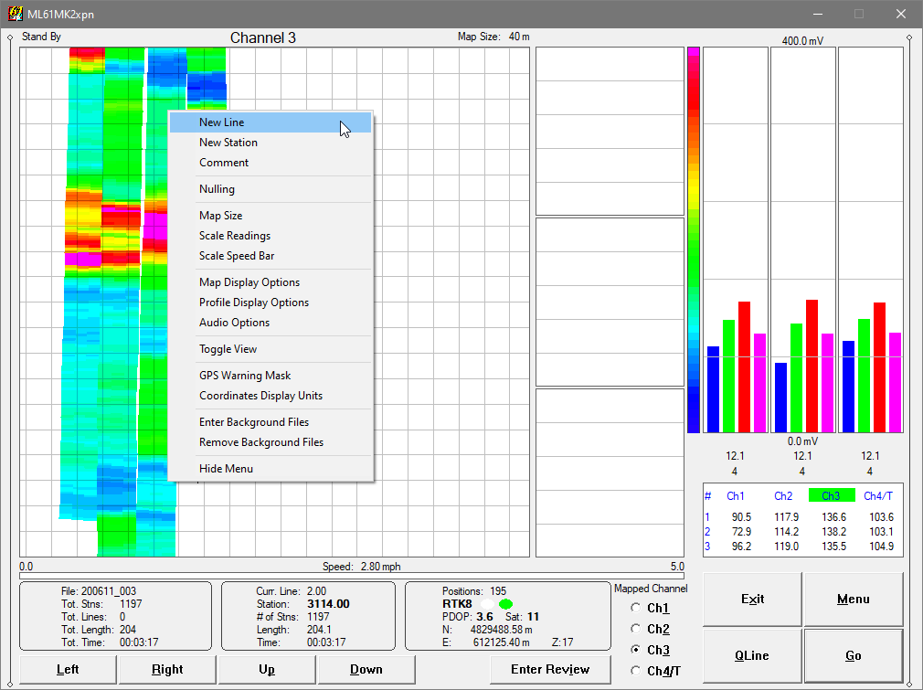
ML61MK2xpn - Pop Up Menu with Additional Options
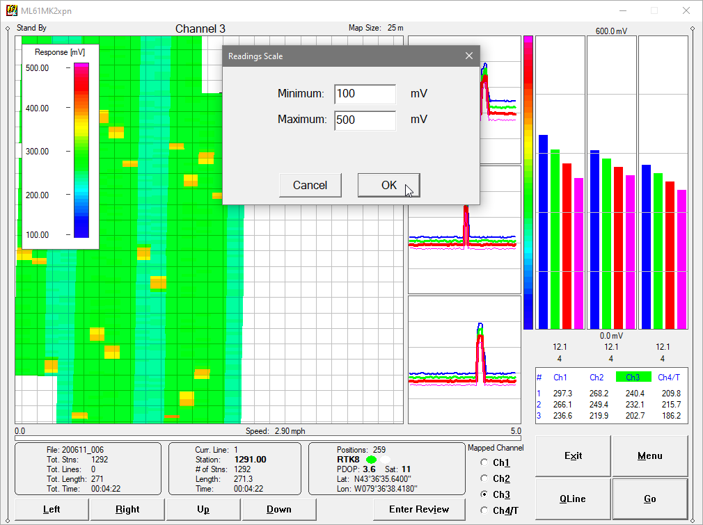
ML61MK2xpn - Specifying Range of Amplitude for Real Time Map