Data Acquisition with Navigation and Real Time Imaging
for Electromagnetic & Magnetic Instruments
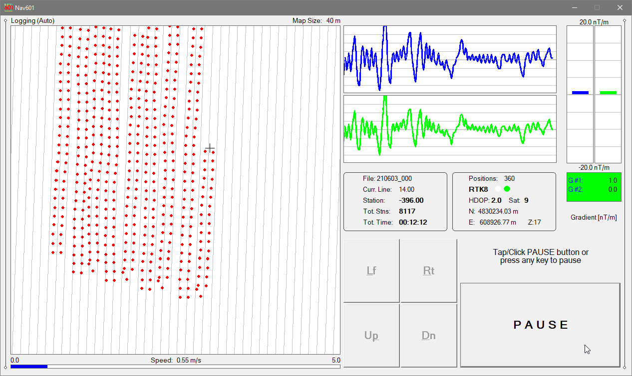
TrackMaker for Windows 11/10 tablets and field laptops records geophysical data and GNSS/GPS positions simultaneously in a single file. A real-time map shows collected stations and the operator’s current location, improving control of survey paths. Instrument status, GNSS data quality,
and settings are continuously monitored and updated on screen.
More About TrackMaker
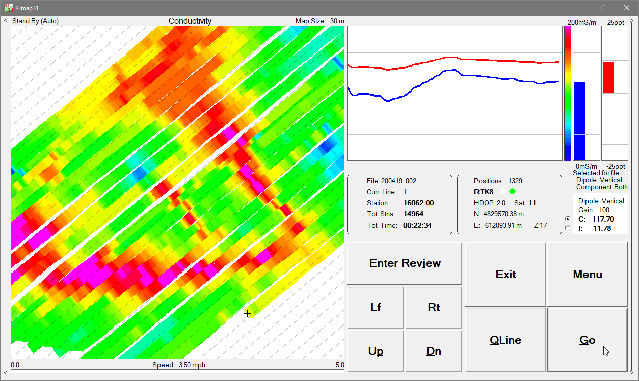
RTmap provides real-time QA/QC and high survey efficiency by displaying live spatial color maps that allow operators
to adjust speed and coverage density as anomalies are detected. Uniform line spacing is maintained while gaps and unnecessary overlap are avoided.
Instrument data quality, system settings, and GNSS/GPS receiver parameters are monitored simultaneously.
More About RTmap
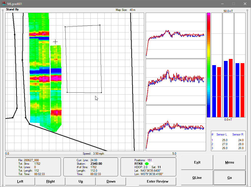
The Multi family of programs supports simultaneous acquisition of instrument readings and GNSS/GPS positions from multiple instruments operating as an array. Data from up to nine consoles and a GPS receiver are recorded in a single file. The Windows-based processing software accurately positions each sensor using GPS data, array geometry, and system heading. Supported instruments include Bartington Grad-601 (up to 9 consoles / 18 sensors) and Geonics EM61-MK2 (up to 9 consoles).
More About Multi
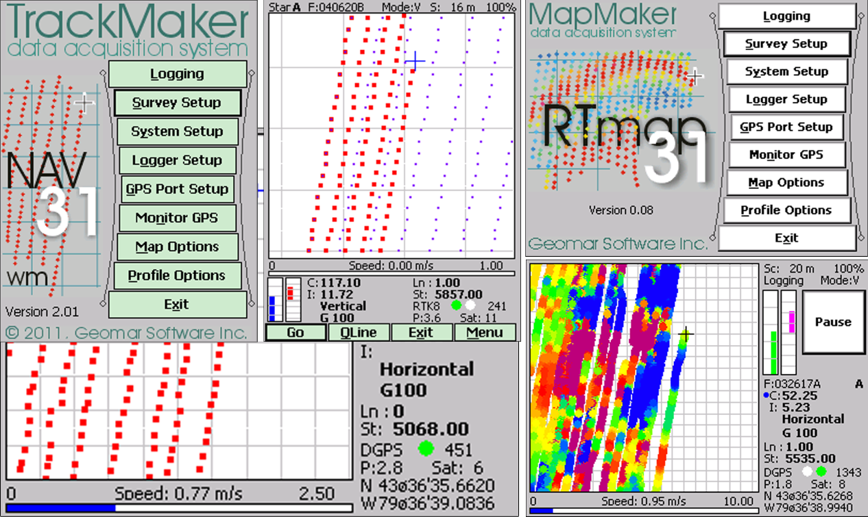
In addition to the current TrackMaker and RTmap software for Windows 11/10, data-logging programs were developed for Windows Mobile (and Windows CE) handheld computers for a wide range of instruments. These programs remain in active use by many field teams and, although no longer under development, continue to be supported and are supplied with current versions of the corresponding processing software. Our data-processing programs are designed to read data files from all corresponding previous versions.
More About Software for Windows Mobile OS