Geomar Software Inc. (formerly Geomar Geophysics Ltd.) has been developing operational software for electromagnetic and magnetic instrumentation for over 30 years. We specialize in focused, practical solutions for precision agriculture, environmental site characterization, unexploded ordnance (UXO), and geotechnical engineering. When unique requirements arise, we work closely with our clients to tailor software to their specific needs.
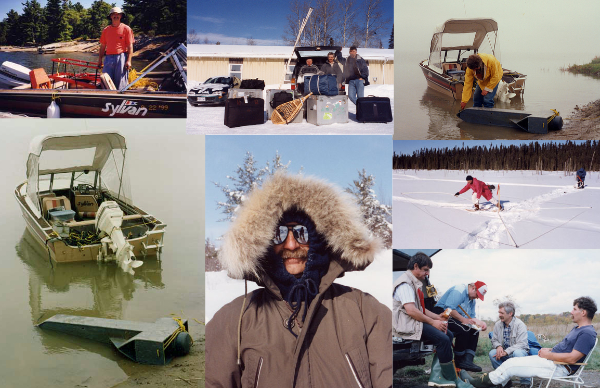
Before transitioning fully to software development, Geomar Geophysics Ltd. conducted hundreds of marine and land geophysical surveys across Canada and the United States, along with extensive data interpretation. This hands-on field experience continues to shape everything we design.
We understand the realities of field work—extreme heat, Arctic cold, rain, wind, rough terrain, and long days that extend past sunset. We know what it means to operate equipment while wearing gloves, how critical button size and responsiveness are, and how essential a clear, intuitive display is for recognizing problems instantly.
This experience translates directly into practical, reliable, operator-focused software. Every feature is designed for real-world conditions—where efficiency, clarity, and dependability are essential.
Since 2002, we have focused exclusively on data acquisition software development. While the field may be behind us, it remains at the core of how we think, design, and refine our software.
We support our customers through a hands-on approach, combining field-proven insight with strong technical expertise in geophysical instrumentation—an advantage that continues to set us apart.